
Columbia Business Loop Improvement Plan
NEW: Following the March 19 open house, an online survey is now available. The survey will remain available through April 10.
The City of Columbia, in coordination with the Loop Community Improvement District and the Missouri Department of Transportation, is beginning work on a Business Loop improvement plan focused on the I-70 Business Loop corridor. This effort is funded through a $2 million Reconnecting Communities Planning Grant and will evaluate how the corridor functions today while identifying opportunities for long-term improvements. The planning process is analyzing the street in detail and produce engineering documents that can guide future capital improvements along the entire corridor.
The project is examining ways to improve transportation and the overall appearance of the Business Loop while strengthening connections between neighborhoods, businesses and key destinations. Potential improvements include upgraded sidewalks, enhanced pedestrian and bicycle connections, stormwater management features, beautification elements and redesigned intersections. Great River Engineering, consultants on the project, are reviewing current conditions and developing potential design concepts that reflect how people move through and use the corridor today.
Community input will play an important role in shaping the plan. Residents, business owners and anyone who travels along the corridor attended the first public open house Thursday, March 19, 2026. The meeting was an open-house format with no formal presentation where participants could stop by, review maps and surveys of existing conditions, see initial improvement ideas and share feedback with the project team.
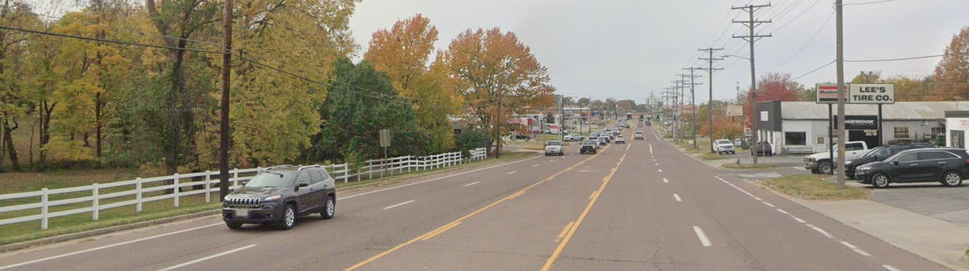
Documents have been added to the sidebar of this page. They include:
- Loop Improvement Schedule for 2026-2027: Comprised of a kick-off in winter 2026, neighborhood meetings in spring 2026, recommendations in summer 2026, and final direction in winter 2026-27.
- Existing Conditions on the Business Loop: Currently more of a high-speed roadway than a community destination, the Loop is characterized by wide lanes, narrow sidewalks, and minimal emphasis on pedestrian and bicycle infrastructure, creating an environment that feels unsafe and unwelcoming.
- Envisioning the Future of the Loop: Offers different options, including urban street trees and planted medians, reduced lanes, and more bike and pedestrian spaces. The positive aspects of roundabouts are also discussed.
- Effective Stormwater Management on the Loop: Provides a history of stormwater runoff impacts in the past, lists where watersheds are located, and offers options for best management practices that reduce runoff before it enters the drainage system.
- West Loop segment map: A map showing the area around Cosmo Park and some alternative approaches to roadway design in this segment, including a three-lane arterial road design with a pedway and street trees.
- East Loop segment map: A map showing the area around College Avenue and Paris Road and some alternative approaches to roadway design in this segment, including a three-lane arterial road design with a pedway and street trees.
- The Loop pedestrian hub map: A map showing the area around Hickman High School along with some alternatives to street design, with parking, pedestrian zones and bicycle lanes.
-
 Loop Improvement Schedule for 2026-2027 (1000 KB) (pdf)
-
Existing Conditions on the Business Loop (14.6 MB) (pdf)
-
Envisioning the Future of The Loop (6.63 MB) (pdf)
-
Effective Stormwater Management on the Loop (700 KB) (pdf)
-
West Loop segment map (13.3 MB) (jpg)
-
East Loop segment map (10.6 MB) (jpg)
-
The Loop pedestrian hub map (18.1 MB) (jpg)

-

Phone 573-874-2489 Email John.Ogan@CoMo.gov