
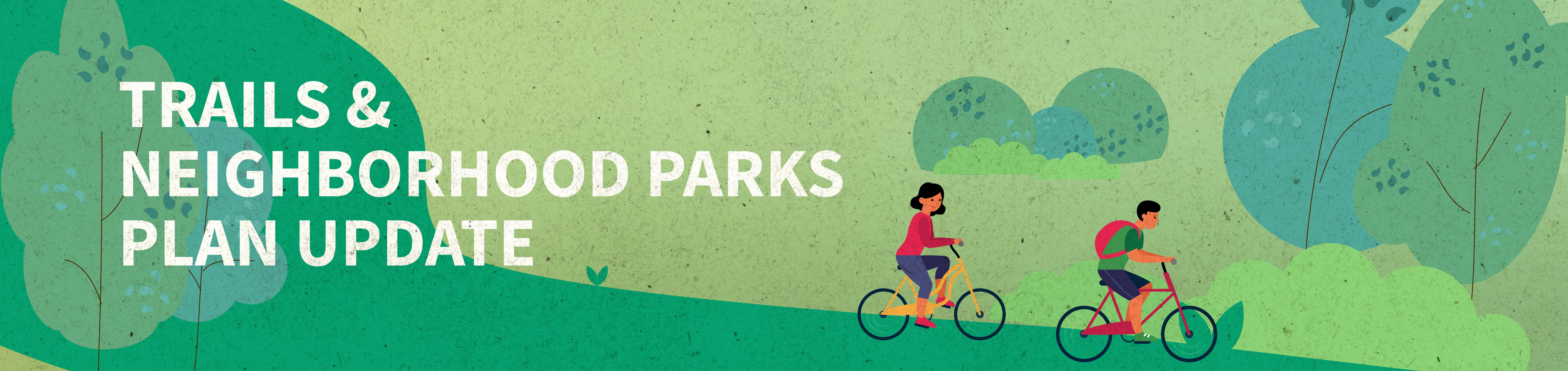
Trails and Neighborhood Parks Plan Update
Columbia Parks and Recreation is updating its neighborhood parks, trails, and open space plans. These plans serve as guides for development over the next few years.
Parks and Recreation planning staff would like your feedback. On this page, you can view the proposed plans and provide input in the comments section below. These comments will be reviewed by planning staff.
If you would prefer offering your feedback in person, you can also attend one of the following public input meetings:
Aug. 20, 8-11 a.m. at Columbia Farmers Market at Clary-Shy Community Park, 1701 W. Ash St.
Aug. 23, 5-7 p.m. at Albert-Oakland Park, Shelter 3, 1900 Blue Ridge Road
Sept. 1, 5-7 p.m. at Indian Hills Park Shelter, 5009 Aztec Blvd.
Sept. 14, 5-7 p.m. at Bonnie View Nature Sanctuary Shelter, 3300 Rollins Road
Sept. 21, 5-7 p.m. at Jay Dix Station Shelter, 3725 S. Scott Blvd.
Sept. 27, 5-7 p.m. at Waters-Moss Memorial Wildlife Area Shelter, 1907 Hillcrest Drive
We look forward to hearing from you.
Trails and Neighborhood Parks Plan Comments
Here is where you can share your thoughts about updates to the Trails and Neighborhood Park plans. Please review the plans and then provide your feedback. Parks and Recreation planning staff will review these comments.
-
Share What are the plans for Little Mates Cove? on Facebook Share What are the plans for Little Mates Cove? on X (formerly Twitter) Share What are the plans for Little Mates Cove? on Linkedin Email What are the plans for Little Mates Cove? link
What are the plans for Little Mates Cove?
loristiers asked over 3 years agoThere is funding available next year from the Park Sales Tax to make improvements at Twin Lakes Recreation Area, including Little Mates Cove. We will hold public input meetings and will post a project page on this site to gain feedback. Staff has discussed several options for Little Mates including replacement. It very likely will not open for the 2023 season.
Thanks for the question!
Tammy Miller
-
Share I see that there is a proposed trail connector from Eastland Hills to the Hominy Creek trail, which would be very welcome since it is unsafe to bike from Eastland Hills to any part of the trail due to high speed traffic and no shoulders. What is the funding status of that connector? Pre-COVID we had been aware of an Eastland Hills Estates homeowner who was willing to allow the City an easement to build a trail connector. Have you contacted the Eastland Hills Estates HOA to see if that individual might still be willing? That would be a much shorter and less expensive connector than one running from Wolf Trail/Kirk Hill Rd. to the Hominy creek trail as appears to be proposed. on Facebook Share I see that there is a proposed trail connector from Eastland Hills to the Hominy Creek trail, which would be very welcome since it is unsafe to bike from Eastland Hills to any part of the trail due to high speed traffic and no shoulders. What is the funding status of that connector? Pre-COVID we had been aware of an Eastland Hills Estates homeowner who was willing to allow the City an easement to build a trail connector. Have you contacted the Eastland Hills Estates HOA to see if that individual might still be willing? That would be a much shorter and less expensive connector than one running from Wolf Trail/Kirk Hill Rd. to the Hominy creek trail as appears to be proposed. on X (formerly Twitter) Share I see that there is a proposed trail connector from Eastland Hills to the Hominy Creek trail, which would be very welcome since it is unsafe to bike from Eastland Hills to any part of the trail due to high speed traffic and no shoulders. What is the funding status of that connector? Pre-COVID we had been aware of an Eastland Hills Estates homeowner who was willing to allow the City an easement to build a trail connector. Have you contacted the Eastland Hills Estates HOA to see if that individual might still be willing? That would be a much shorter and less expensive connector than one running from Wolf Trail/Kirk Hill Rd. to the Hominy creek trail as appears to be proposed. on Linkedin Email I see that there is a proposed trail connector from Eastland Hills to the Hominy Creek trail, which would be very welcome since it is unsafe to bike from Eastland Hills to any part of the trail due to high speed traffic and no shoulders. What is the funding status of that connector? Pre-COVID we had been aware of an Eastland Hills Estates homeowner who was willing to allow the City an easement to build a trail connector. Have you contacted the Eastland Hills Estates HOA to see if that individual might still be willing? That would be a much shorter and less expensive connector than one running from Wolf Trail/Kirk Hill Rd. to the Hominy creek trail as appears to be proposed. link
I see that there is a proposed trail connector from Eastland Hills to the Hominy Creek trail, which would be very welcome since it is unsafe to bike from Eastland Hills to any part of the trail due to high speed traffic and no shoulders. What is the funding status of that connector? Pre-COVID we had been aware of an Eastland Hills Estates homeowner who was willing to allow the City an easement to build a trail connector. Have you contacted the Eastland Hills Estates HOA to see if that individual might still be willing? That would be a much shorter and less expensive connector than one running from Wolf Trail/Kirk Hill Rd. to the Hominy creek trail as appears to be proposed.
tgull asked almost 4 years agoThere is no funding for this trail at this time. When funding is available we will have public input meetings and do detailed planning that will include options for the trail location. I hope this helps. Thank you for your input.
Mike Snyder
-
Share Can we have more trash cans and porta potties on the trails. I have to carry my dog’s poop for a mile before I can throw it away, I believe this is why I see more dog poop on the trails. on Facebook Share Can we have more trash cans and porta potties on the trails. I have to carry my dog’s poop for a mile before I can throw it away, I believe this is why I see more dog poop on the trails. on X (formerly Twitter) Share Can we have more trash cans and porta potties on the trails. I have to carry my dog’s poop for a mile before I can throw it away, I believe this is why I see more dog poop on the trails. on Linkedin Email Can we have more trash cans and porta potties on the trails. I have to carry my dog’s poop for a mile before I can throw it away, I believe this is why I see more dog poop on the trails. link
Can we have more trash cans and porta potties on the trails. I have to carry my dog’s poop for a mile before I can throw it away, I believe this is why I see more dog poop on the trails.
Dianna asked almost 4 years agoThank you for your comment and for picking up after your pet! We provide trash cans and restroom facilities at most trailheads. However, we typically do not place cans along trails because our maintenance staff would have to drive on the trails to empty them. We try to avoid the conflict of vehicles and trail users as much as possible, for the safety of cyclists and pedestrians. If you have any further questions or comments about this, please email Janet.Godon@CoMo.gov. Thanks again for your feedback!
-
Share I appreciate you responding below, but no, nothing I said is directed for public works. If I want to make notes about sidewalks or bike lanes or street improvements, I will address that to them. What I am encouraging is for parks and recs to think of themselves as an Integral component of the transportation plan and to build out as if that was their goal, too. I am assuming that you are putting trails in most places it is easy to do so and this map represents that, so I am looking at places where that cannot happen and advocating for side-street bike paths. That obviously requires coordination with public works, of course, but all of my suggestions involved things that parks and recs has some sway over. I suggested 4-5 streets to add side paths and think a comprehensive look at the city should be done to see where more can be added beyond what I mentioned. And I think the criteria for that analysis should be where do people need or want to go (eg doctors offices and schools and football games), feasibility (of course), as well as how to create more connectivity between the trail system and the on street system (yes run by PW). I further suggested safety upgrades to the trail system such as wider lanes on mountainous curves, better signage at confusing trail or trail/road intersections, and no more trails that run through parking lots (and any trails that do to be rerouted to skirt around them). Thank you for this opportunity to provide clarification. on Facebook Share I appreciate you responding below, but no, nothing I said is directed for public works. If I want to make notes about sidewalks or bike lanes or street improvements, I will address that to them. What I am encouraging is for parks and recs to think of themselves as an Integral component of the transportation plan and to build out as if that was their goal, too. I am assuming that you are putting trails in most places it is easy to do so and this map represents that, so I am looking at places where that cannot happen and advocating for side-street bike paths. That obviously requires coordination with public works, of course, but all of my suggestions involved things that parks and recs has some sway over. I suggested 4-5 streets to add side paths and think a comprehensive look at the city should be done to see where more can be added beyond what I mentioned. And I think the criteria for that analysis should be where do people need or want to go (eg doctors offices and schools and football games), feasibility (of course), as well as how to create more connectivity between the trail system and the on street system (yes run by PW). I further suggested safety upgrades to the trail system such as wider lanes on mountainous curves, better signage at confusing trail or trail/road intersections, and no more trails that run through parking lots (and any trails that do to be rerouted to skirt around them). Thank you for this opportunity to provide clarification. on X (formerly Twitter) Share I appreciate you responding below, but no, nothing I said is directed for public works. If I want to make notes about sidewalks or bike lanes or street improvements, I will address that to them. What I am encouraging is for parks and recs to think of themselves as an Integral component of the transportation plan and to build out as if that was their goal, too. I am assuming that you are putting trails in most places it is easy to do so and this map represents that, so I am looking at places where that cannot happen and advocating for side-street bike paths. That obviously requires coordination with public works, of course, but all of my suggestions involved things that parks and recs has some sway over. I suggested 4-5 streets to add side paths and think a comprehensive look at the city should be done to see where more can be added beyond what I mentioned. And I think the criteria for that analysis should be where do people need or want to go (eg doctors offices and schools and football games), feasibility (of course), as well as how to create more connectivity between the trail system and the on street system (yes run by PW). I further suggested safety upgrades to the trail system such as wider lanes on mountainous curves, better signage at confusing trail or trail/road intersections, and no more trails that run through parking lots (and any trails that do to be rerouted to skirt around them). Thank you for this opportunity to provide clarification. on Linkedin Email I appreciate you responding below, but no, nothing I said is directed for public works. If I want to make notes about sidewalks or bike lanes or street improvements, I will address that to them. What I am encouraging is for parks and recs to think of themselves as an Integral component of the transportation plan and to build out as if that was their goal, too. I am assuming that you are putting trails in most places it is easy to do so and this map represents that, so I am looking at places where that cannot happen and advocating for side-street bike paths. That obviously requires coordination with public works, of course, but all of my suggestions involved things that parks and recs has some sway over. I suggested 4-5 streets to add side paths and think a comprehensive look at the city should be done to see where more can be added beyond what I mentioned. And I think the criteria for that analysis should be where do people need or want to go (eg doctors offices and schools and football games), feasibility (of course), as well as how to create more connectivity between the trail system and the on street system (yes run by PW). I further suggested safety upgrades to the trail system such as wider lanes on mountainous curves, better signage at confusing trail or trail/road intersections, and no more trails that run through parking lots (and any trails that do to be rerouted to skirt around them). Thank you for this opportunity to provide clarification. link
I appreciate you responding below, but no, nothing I said is directed for public works. If I want to make notes about sidewalks or bike lanes or street improvements, I will address that to them. What I am encouraging is for parks and recs to think of themselves as an Integral component of the transportation plan and to build out as if that was their goal, too. I am assuming that you are putting trails in most places it is easy to do so and this map represents that, so I am looking at places where that cannot happen and advocating for side-street bike paths. That obviously requires coordination with public works, of course, but all of my suggestions involved things that parks and recs has some sway over. I suggested 4-5 streets to add side paths and think a comprehensive look at the city should be done to see where more can be added beyond what I mentioned. And I think the criteria for that analysis should be where do people need or want to go (eg doctors offices and schools and football games), feasibility (of course), as well as how to create more connectivity between the trail system and the on street system (yes run by PW). I further suggested safety upgrades to the trail system such as wider lanes on mountainous curves, better signage at confusing trail or trail/road intersections, and no more trails that run through parking lots (and any trails that do to be rerouted to skirt around them). Thank you for this opportunity to provide clarification.
R asked almost 4 years agoThank you for your feedback!
-
Share Hello! One improvement that would enhance our parks is adding shade canopies to some of the city park playgrounds. For example, Twin Lakes and Clary-Shy have great playgrounds that are in the direct sun. Adding shade canopies and/or benches with permanent umbrellas would be such a great improvement. Thanks! on Facebook Share Hello! One improvement that would enhance our parks is adding shade canopies to some of the city park playgrounds. For example, Twin Lakes and Clary-Shy have great playgrounds that are in the direct sun. Adding shade canopies and/or benches with permanent umbrellas would be such a great improvement. Thanks! on X (formerly Twitter) Share Hello! One improvement that would enhance our parks is adding shade canopies to some of the city park playgrounds. For example, Twin Lakes and Clary-Shy have great playgrounds that are in the direct sun. Adding shade canopies and/or benches with permanent umbrellas would be such a great improvement. Thanks! on Linkedin Email Hello! One improvement that would enhance our parks is adding shade canopies to some of the city park playgrounds. For example, Twin Lakes and Clary-Shy have great playgrounds that are in the direct sun. Adding shade canopies and/or benches with permanent umbrellas would be such a great improvement. Thanks! link
Hello! One improvement that would enhance our parks is adding shade canopies to some of the city park playgrounds. For example, Twin Lakes and Clary-Shy have great playgrounds that are in the direct sun. Adding shade canopies and/or benches with permanent umbrellas would be such a great improvement. Thanks!
Brennamz1 asked almost 4 years agoThank you for your feedback! Our planning staff has taken note of your comments.
-
Share We live on WW East of town in the El Chaparral and Vineyards area. We are excited to see work underway at Vineyards Lake Park. There is so much housing development near the Brooks and Vineyards near the new elementary school and Old Hawthorne. I would love to bike to work but currently there are no bike trails near our area and WW is too dangerous to connect to Hominy trail. Are there any plans for Vineyard Lake Park to add a bike trail that hooks up to the Stadium area, not sure of the bike trail near there? We are so close to where East stadium ends but no trail connection to the city. on Facebook Share We live on WW East of town in the El Chaparral and Vineyards area. We are excited to see work underway at Vineyards Lake Park. There is so much housing development near the Brooks and Vineyards near the new elementary school and Old Hawthorne. I would love to bike to work but currently there are no bike trails near our area and WW is too dangerous to connect to Hominy trail. Are there any plans for Vineyard Lake Park to add a bike trail that hooks up to the Stadium area, not sure of the bike trail near there? We are so close to where East stadium ends but no trail connection to the city. on X (formerly Twitter) Share We live on WW East of town in the El Chaparral and Vineyards area. We are excited to see work underway at Vineyards Lake Park. There is so much housing development near the Brooks and Vineyards near the new elementary school and Old Hawthorne. I would love to bike to work but currently there are no bike trails near our area and WW is too dangerous to connect to Hominy trail. Are there any plans for Vineyard Lake Park to add a bike trail that hooks up to the Stadium area, not sure of the bike trail near there? We are so close to where East stadium ends but no trail connection to the city. on Linkedin Email We live on WW East of town in the El Chaparral and Vineyards area. We are excited to see work underway at Vineyards Lake Park. There is so much housing development near the Brooks and Vineyards near the new elementary school and Old Hawthorne. I would love to bike to work but currently there are no bike trails near our area and WW is too dangerous to connect to Hominy trail. Are there any plans for Vineyard Lake Park to add a bike trail that hooks up to the Stadium area, not sure of the bike trail near there? We are so close to where East stadium ends but no trail connection to the city. link
We live on WW East of town in the El Chaparral and Vineyards area. We are excited to see work underway at Vineyards Lake Park. There is so much housing development near the Brooks and Vineyards near the new elementary school and Old Hawthorne. I would love to bike to work but currently there are no bike trails near our area and WW is too dangerous to connect to Hominy trail. Are there any plans for Vineyard Lake Park to add a bike trail that hooks up to the Stadium area, not sure of the bike trail near there? We are so close to where East stadium ends but no trail connection to the city.
kfaddis asked almost 4 years agoThank you for your comment. Here is a detail of the proposed trails in your part of town. As you can see there are several trails proposed in this area, unfortunately none of them are funded at this time. There are sections of the North and South Forks of Grindstone Creek Trail that are primary priorities (purple) however having just passed the park sales tax that includes funding for the next ten years, it is not likely that either of these trails will be built until our next ballot issue that will occur in 2032. I hope this helps.
Mike Snyder, Park Planning and Development Superintendent

-
Share Hello, I am a bicyclist as my primary mode of transportation. Columbia may have won a regional silver award for bicycling trails a few years back, but that was clearly for recreation, as if everyone could drive and park at a parking lot and get on a trail. Of course, you are the Parks and Recreation department, but what connections can be made to Public Works to ensure connectivity with on-street bike lanes and connectivity between trails so that it is truly a comprehensive transportation network that allows a person to go from Point A to Point B instead of just some nice trails for a free saturday? It's great you are building a trail out to Olivet and down Olivet, but who lives out there to take advantage of it compared to making safe biking for those who live in the City itself a priority? It should be safe to get anywhere in town on 2 wheels (or 4 in the case of wheelchairs). What would that look like in Parks and Recs domain? Most of the trails go in a Northeast-Southwesterly direction, presumably because that's the way the water flows towards the River. But if someone needs to go straight North-South, or Northwest-Southwesterly, how do they do so safely on a bike in this city? The answer is, they don't. I've lived in many cities around the US and Columbia by far is one of the least safe for bicycling. So I don't know if you are responsible for the black line of "Other Trails or Sidepaths" or if that is PW, but I would love to see more of those appear on this plan as well as more connector trails. Large gaps that seem potential (e.g. I'm not proposing rock quarry road for example) include: one going down Forum Blvd from Stadium to Old Plank; One going down Southhampton to Nifong with connectors to the Mill Creek Trail and Nifong Park (I would propose Nifong/Vawter all the way but that seems too high traffic so this is my best alternative); down the rest of Providence filling in the existing gaps to make that a path that could actually be used & because there is almost no safe way to get across the highway on a bike, garth being the only somewhat safe option; Clark all the way until it connects with the Hinkson Creek extension, and I'm sure there are many more if I was able to drive or ride the City with an eye out to this). Where do people need to go? How can you get them there safely? For example, there are a lot of doctors' offices on Keene street--is there a way to extend the the Hominy Creek branch or the black trail on Broadway so that folks could get to their doctors easily? What about safer routes on areas that have laughably unsafe bike trails, like extending the black pedway on Stadium the full length rather than just the section by MU? Those bike lines are too close to traffic, are always parked up on game day, and there is no safe way for folks to walk. I would also encourage parks and recs to think of the safety of the routes themselves--the Greenbriar trail, for example, is actually not wide enough with big enough turning radii for bikes going down to avoid having to swerve into the oncoming lane. And many trails go through parking lots which should never happen!!! That's an easy fix to just extend the trails around traffic. Cars are baking up with low visibility--why would we add bikes to that mix? Plus, many don't have very good signage when multiple trails come together. I think this is a great start and certainly more exciting than the last plan, but it still seems created for a weekend saunter--which is great!--but where it needs to go to be used to the fullest extent possible is as part of a transportation plan. Take a look at this for an example of what Columbia could be: https://bouldercolorado.gov/services/bike on Facebook Share Hello, I am a bicyclist as my primary mode of transportation. Columbia may have won a regional silver award for bicycling trails a few years back, but that was clearly for recreation, as if everyone could drive and park at a parking lot and get on a trail. Of course, you are the Parks and Recreation department, but what connections can be made to Public Works to ensure connectivity with on-street bike lanes and connectivity between trails so that it is truly a comprehensive transportation network that allows a person to go from Point A to Point B instead of just some nice trails for a free saturday? It's great you are building a trail out to Olivet and down Olivet, but who lives out there to take advantage of it compared to making safe biking for those who live in the City itself a priority? It should be safe to get anywhere in town on 2 wheels (or 4 in the case of wheelchairs). What would that look like in Parks and Recs domain? Most of the trails go in a Northeast-Southwesterly direction, presumably because that's the way the water flows towards the River. But if someone needs to go straight North-South, or Northwest-Southwesterly, how do they do so safely on a bike in this city? The answer is, they don't. I've lived in many cities around the US and Columbia by far is one of the least safe for bicycling. So I don't know if you are responsible for the black line of "Other Trails or Sidepaths" or if that is PW, but I would love to see more of those appear on this plan as well as more connector trails. Large gaps that seem potential (e.g. I'm not proposing rock quarry road for example) include: one going down Forum Blvd from Stadium to Old Plank; One going down Southhampton to Nifong with connectors to the Mill Creek Trail and Nifong Park (I would propose Nifong/Vawter all the way but that seems too high traffic so this is my best alternative); down the rest of Providence filling in the existing gaps to make that a path that could actually be used & because there is almost no safe way to get across the highway on a bike, garth being the only somewhat safe option; Clark all the way until it connects with the Hinkson Creek extension, and I'm sure there are many more if I was able to drive or ride the City with an eye out to this). Where do people need to go? How can you get them there safely? For example, there are a lot of doctors' offices on Keene street--is there a way to extend the the Hominy Creek branch or the black trail on Broadway so that folks could get to their doctors easily? What about safer routes on areas that have laughably unsafe bike trails, like extending the black pedway on Stadium the full length rather than just the section by MU? Those bike lines are too close to traffic, are always parked up on game day, and there is no safe way for folks to walk. I would also encourage parks and recs to think of the safety of the routes themselves--the Greenbriar trail, for example, is actually not wide enough with big enough turning radii for bikes going down to avoid having to swerve into the oncoming lane. And many trails go through parking lots which should never happen!!! That's an easy fix to just extend the trails around traffic. Cars are baking up with low visibility--why would we add bikes to that mix? Plus, many don't have very good signage when multiple trails come together. I think this is a great start and certainly more exciting than the last plan, but it still seems created for a weekend saunter--which is great!--but where it needs to go to be used to the fullest extent possible is as part of a transportation plan. Take a look at this for an example of what Columbia could be: https://bouldercolorado.gov/services/bike on X (formerly Twitter) Share Hello, I am a bicyclist as my primary mode of transportation. Columbia may have won a regional silver award for bicycling trails a few years back, but that was clearly for recreation, as if everyone could drive and park at a parking lot and get on a trail. Of course, you are the Parks and Recreation department, but what connections can be made to Public Works to ensure connectivity with on-street bike lanes and connectivity between trails so that it is truly a comprehensive transportation network that allows a person to go from Point A to Point B instead of just some nice trails for a free saturday? It's great you are building a trail out to Olivet and down Olivet, but who lives out there to take advantage of it compared to making safe biking for those who live in the City itself a priority? It should be safe to get anywhere in town on 2 wheels (or 4 in the case of wheelchairs). What would that look like in Parks and Recs domain? Most of the trails go in a Northeast-Southwesterly direction, presumably because that's the way the water flows towards the River. But if someone needs to go straight North-South, or Northwest-Southwesterly, how do they do so safely on a bike in this city? The answer is, they don't. I've lived in many cities around the US and Columbia by far is one of the least safe for bicycling. So I don't know if you are responsible for the black line of "Other Trails or Sidepaths" or if that is PW, but I would love to see more of those appear on this plan as well as more connector trails. Large gaps that seem potential (e.g. I'm not proposing rock quarry road for example) include: one going down Forum Blvd from Stadium to Old Plank; One going down Southhampton to Nifong with connectors to the Mill Creek Trail and Nifong Park (I would propose Nifong/Vawter all the way but that seems too high traffic so this is my best alternative); down the rest of Providence filling in the existing gaps to make that a path that could actually be used & because there is almost no safe way to get across the highway on a bike, garth being the only somewhat safe option; Clark all the way until it connects with the Hinkson Creek extension, and I'm sure there are many more if I was able to drive or ride the City with an eye out to this). Where do people need to go? How can you get them there safely? For example, there are a lot of doctors' offices on Keene street--is there a way to extend the the Hominy Creek branch or the black trail on Broadway so that folks could get to their doctors easily? What about safer routes on areas that have laughably unsafe bike trails, like extending the black pedway on Stadium the full length rather than just the section by MU? Those bike lines are too close to traffic, are always parked up on game day, and there is no safe way for folks to walk. I would also encourage parks and recs to think of the safety of the routes themselves--the Greenbriar trail, for example, is actually not wide enough with big enough turning radii for bikes going down to avoid having to swerve into the oncoming lane. And many trails go through parking lots which should never happen!!! That's an easy fix to just extend the trails around traffic. Cars are baking up with low visibility--why would we add bikes to that mix? Plus, many don't have very good signage when multiple trails come together. I think this is a great start and certainly more exciting than the last plan, but it still seems created for a weekend saunter--which is great!--but where it needs to go to be used to the fullest extent possible is as part of a transportation plan. Take a look at this for an example of what Columbia could be: https://bouldercolorado.gov/services/bike on Linkedin Email Hello, I am a bicyclist as my primary mode of transportation. Columbia may have won a regional silver award for bicycling trails a few years back, but that was clearly for recreation, as if everyone could drive and park at a parking lot and get on a trail. Of course, you are the Parks and Recreation department, but what connections can be made to Public Works to ensure connectivity with on-street bike lanes and connectivity between trails so that it is truly a comprehensive transportation network that allows a person to go from Point A to Point B instead of just some nice trails for a free saturday? It's great you are building a trail out to Olivet and down Olivet, but who lives out there to take advantage of it compared to making safe biking for those who live in the City itself a priority? It should be safe to get anywhere in town on 2 wheels (or 4 in the case of wheelchairs). What would that look like in Parks and Recs domain? Most of the trails go in a Northeast-Southwesterly direction, presumably because that's the way the water flows towards the River. But if someone needs to go straight North-South, or Northwest-Southwesterly, how do they do so safely on a bike in this city? The answer is, they don't. I've lived in many cities around the US and Columbia by far is one of the least safe for bicycling. So I don't know if you are responsible for the black line of "Other Trails or Sidepaths" or if that is PW, but I would love to see more of those appear on this plan as well as more connector trails. Large gaps that seem potential (e.g. I'm not proposing rock quarry road for example) include: one going down Forum Blvd from Stadium to Old Plank; One going down Southhampton to Nifong with connectors to the Mill Creek Trail and Nifong Park (I would propose Nifong/Vawter all the way but that seems too high traffic so this is my best alternative); down the rest of Providence filling in the existing gaps to make that a path that could actually be used & because there is almost no safe way to get across the highway on a bike, garth being the only somewhat safe option; Clark all the way until it connects with the Hinkson Creek extension, and I'm sure there are many more if I was able to drive or ride the City with an eye out to this). Where do people need to go? How can you get them there safely? For example, there are a lot of doctors' offices on Keene street--is there a way to extend the the Hominy Creek branch or the black trail on Broadway so that folks could get to their doctors easily? What about safer routes on areas that have laughably unsafe bike trails, like extending the black pedway on Stadium the full length rather than just the section by MU? Those bike lines are too close to traffic, are always parked up on game day, and there is no safe way for folks to walk. I would also encourage parks and recs to think of the safety of the routes themselves--the Greenbriar trail, for example, is actually not wide enough with big enough turning radii for bikes going down to avoid having to swerve into the oncoming lane. And many trails go through parking lots which should never happen!!! That's an easy fix to just extend the trails around traffic. Cars are baking up with low visibility--why would we add bikes to that mix? Plus, many don't have very good signage when multiple trails come together. I think this is a great start and certainly more exciting than the last plan, but it still seems created for a weekend saunter--which is great!--but where it needs to go to be used to the fullest extent possible is as part of a transportation plan. Take a look at this for an example of what Columbia could be: https://bouldercolorado.gov/services/bike link
Hello, I am a bicyclist as my primary mode of transportation. Columbia may have won a regional silver award for bicycling trails a few years back, but that was clearly for recreation, as if everyone could drive and park at a parking lot and get on a trail. Of course, you are the Parks and Recreation department, but what connections can be made to Public Works to ensure connectivity with on-street bike lanes and connectivity between trails so that it is truly a comprehensive transportation network that allows a person to go from Point A to Point B instead of just some nice trails for a free saturday? It's great you are building a trail out to Olivet and down Olivet, but who lives out there to take advantage of it compared to making safe biking for those who live in the City itself a priority? It should be safe to get anywhere in town on 2 wheels (or 4 in the case of wheelchairs). What would that look like in Parks and Recs domain? Most of the trails go in a Northeast-Southwesterly direction, presumably because that's the way the water flows towards the River. But if someone needs to go straight North-South, or Northwest-Southwesterly, how do they do so safely on a bike in this city? The answer is, they don't. I've lived in many cities around the US and Columbia by far is one of the least safe for bicycling. So I don't know if you are responsible for the black line of "Other Trails or Sidepaths" or if that is PW, but I would love to see more of those appear on this plan as well as more connector trails. Large gaps that seem potential (e.g. I'm not proposing rock quarry road for example) include: one going down Forum Blvd from Stadium to Old Plank; One going down Southhampton to Nifong with connectors to the Mill Creek Trail and Nifong Park (I would propose Nifong/Vawter all the way but that seems too high traffic so this is my best alternative); down the rest of Providence filling in the existing gaps to make that a path that could actually be used & because there is almost no safe way to get across the highway on a bike, garth being the only somewhat safe option; Clark all the way until it connects with the Hinkson Creek extension, and I'm sure there are many more if I was able to drive or ride the City with an eye out to this). Where do people need to go? How can you get them there safely? For example, there are a lot of doctors' offices on Keene street--is there a way to extend the the Hominy Creek branch or the black trail on Broadway so that folks could get to their doctors easily? What about safer routes on areas that have laughably unsafe bike trails, like extending the black pedway on Stadium the full length rather than just the section by MU? Those bike lines are too close to traffic, are always parked up on game day, and there is no safe way for folks to walk. I would also encourage parks and recs to think of the safety of the routes themselves--the Greenbriar trail, for example, is actually not wide enough with big enough turning radii for bikes going down to avoid having to swerve into the oncoming lane. And many trails go through parking lots which should never happen!!! That's an easy fix to just extend the trails around traffic. Cars are baking up with low visibility--why would we add bikes to that mix? Plus, many don't have very good signage when multiple trails come together. I think this is a great start and certainly more exciting than the last plan, but it still seems created for a weekend saunter--which is great!--but where it needs to go to be used to the fullest extent possible is as part of a transportation plan. Take a look at this for an example of what Columbia could be: https://bouldercolorado.gov/services/bike
R asked almost 4 years agoThank you for your input. It seems that most of your feedback is for the City's Public Works Streets Division. They are the Department that handles roads, bike lanes and sidewalks. The Parks and Recreation Department builds trails that are for recreation and fitness as well as transportation. Our plan does show some on-road proposed sidepaths, where the potential for a trail (separate from the automobile) does not exist. We do work with our Public Works Street Division to coordinate connectivity, however the scope of our Trails Plan does not include street improvements. I hope this helps.Mike Snyder, Park Planning and Development Superintendent -
Share Could we please get more tennis courts in town? On the west side, there is only Fairview Park and those courts are in need of repairs due to severe cracking. There is also an absence of swing sets in parks on the west side of town. Thank you! on Facebook Share Could we please get more tennis courts in town? On the west side, there is only Fairview Park and those courts are in need of repairs due to severe cracking. There is also an absence of swing sets in parks on the west side of town. Thank you! on X (formerly Twitter) Share Could we please get more tennis courts in town? On the west side, there is only Fairview Park and those courts are in need of repairs due to severe cracking. There is also an absence of swing sets in parks on the west side of town. Thank you! on Linkedin Email Could we please get more tennis courts in town? On the west side, there is only Fairview Park and those courts are in need of repairs due to severe cracking. There is also an absence of swing sets in parks on the west side of town. Thank you! link
Could we please get more tennis courts in town? On the west side, there is only Fairview Park and those courts are in need of repairs due to severe cracking. There is also an absence of swing sets in parks on the west side of town. Thank you!
RossB asked almost 4 years agoThank you for the comment, we've passed that along to our park planning staff. There are also eight courts at Cosmo Park and 12 at Cosmo-Bethel Park in southwest Columbia. Some of the parks on the west side that feature swings include Jay Dix Station, Cosmo-Bethel, Oakwood Hills and Rock Bridge neighborhood park. Thank you again for your feedback!
-
Share A connection from the north end of proposed Little Bonne Femme Creek Trail to the Gans Creek Trail would form a great loop trail via KATY and MKT. Why not? on Facebook Share A connection from the north end of proposed Little Bonne Femme Creek Trail to the Gans Creek Trail would form a great loop trail via KATY and MKT. Why not? on X (formerly Twitter) Share A connection from the north end of proposed Little Bonne Femme Creek Trail to the Gans Creek Trail would form a great loop trail via KATY and MKT. Why not? on Linkedin Email A connection from the north end of proposed Little Bonne Femme Creek Trail to the Gans Creek Trail would form a great loop trail via KATY and MKT. Why not? link
A connection from the north end of proposed Little Bonne Femme Creek Trail to the Gans Creek Trail would form a great loop trail via KATY and MKT. Why not?
JimB asked almost 4 years agoThank you for the input. Our current proposed trails plan 2023 update would use portions of the Rock Bridge State Park trail system and the future Clear Creek Trail to connect from the north end of Little Bonne Femme Creek Trail to the Gans Creek Trail. I hope this helps. Please let us know if you are proposing a different connection. Thank you.
Mike Snyder
-
Share I'm excited about the proposed trail from Gillespie Bridge to Smith. Is this currently scheduled to be done after the trail from MKT to Gillespie Bridge? When would that happen and what is the plan to connect that part of the trail to Smith? Right now it looks like it would be a very steep drop from Smith down to the field that is bordered by Perche Creek. on Facebook Share I'm excited about the proposed trail from Gillespie Bridge to Smith. Is this currently scheduled to be done after the trail from MKT to Gillespie Bridge? When would that happen and what is the plan to connect that part of the trail to Smith? Right now it looks like it would be a very steep drop from Smith down to the field that is bordered by Perche Creek. on X (formerly Twitter) Share I'm excited about the proposed trail from Gillespie Bridge to Smith. Is this currently scheduled to be done after the trail from MKT to Gillespie Bridge? When would that happen and what is the plan to connect that part of the trail to Smith? Right now it looks like it would be a very steep drop from Smith down to the field that is bordered by Perche Creek. on Linkedin Email I'm excited about the proposed trail from Gillespie Bridge to Smith. Is this currently scheduled to be done after the trail from MKT to Gillespie Bridge? When would that happen and what is the plan to connect that part of the trail to Smith? Right now it looks like it would be a very steep drop from Smith down to the field that is bordered by Perche Creek. link
I'm excited about the proposed trail from Gillespie Bridge to Smith. Is this currently scheduled to be done after the trail from MKT to Gillespie Bridge? When would that happen and what is the plan to connect that part of the trail to Smith? Right now it looks like it would be a very steep drop from Smith down to the field that is bordered by Perche Creek.
comodude57 asked almost 4 years agoThank you for your comments and questions regarding the future phase of the Perche CreekTrail. We have funding to begin construction on the Perche Creek Trail from Gillespie Bridge Road to Smith Drive in October 2025. You are correct that any connection from the end of Smith Drive down to the Perche valley below will have steep slopes. We will likely work with our Public Works Street Division to utilize the Smith Drive right of way to create a connection from the homes along Smith Drive down to the future trail below. Please let me know if you have any other questions or comments.
Mike Snyder, Park Development Superintendent
-

Phone 573-874-7203 Email Mike.Snyder@CoMo.gov -
Phone 573-874-7465 Email Tammy.Miller@CoMo.gov

-
August 20 2022
-
August 23 2022
-
September 01 2022
-
September 14 2022
-
September 21 2022
Thank you for your contribution!
Help us reach out to more people in the community
Share this with family and friends